PHASE TWO: CONCEPTUAL SOLUTIONS
OVERVIEW

PUBLIC COMMENT SUMMARY REPORT
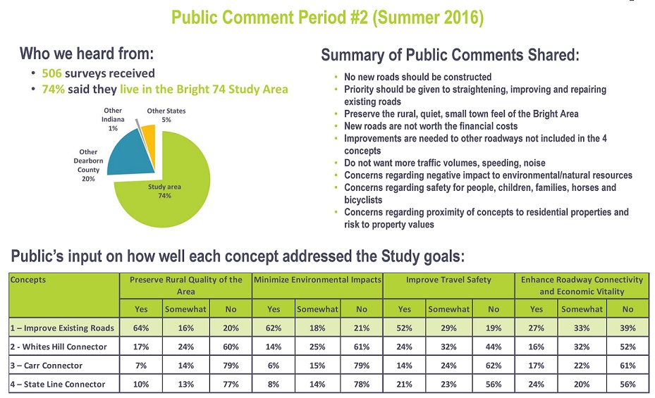
The Phase Two Public Comment Summary Report provides a detailed view of public outreach activities and comments received through all outlets during the second phase of the Bright 74 Study (June 22, 2016 through July 22, 2016). The public role is advisory in order to help the Study Team understand usage and values to guide study decisions. The outcome of Phase Two is to have the public’s and Advisory Committee’s input on the four conceptual solutions to help hone in on 1 or 2 concepts that will be further refined, evaluated and presented in Phase 3 of the Study.
- Click HERE for the Public Comment Summary Report for Phase Two. The appendices mentioned in the report can be opened by clicking the below individual links:
- Click HERE to open a file that summarizes all responses for each survey question in tables and graphics
- Click HERE to open a file containing each of the 506 individual surveys that were received. (PLEASE NOTE the surveys are numbered in this file from 1 to 244 and 1 to 262 rather than 1 to 506. Due to Survey Monkey’s file size limitations, we had to download all survey responses as two files, which we then merged into one file for ease of viewing. The file presents all 469 surveys as they were chronologically received via the online survey, as well as the additional 37 paper surveys that were received (13 from the June 22 Public Open House, 19 collected from the North Dearborn Public Library and 5 mailed directly to OKI). The paper surveys were inputted into Survey Monkey by OKI staff the morning of July 25. Hence, the total survey tally of 506).
Draft Purpose and Need Statement
Following the conclusion of Phase One’s public comment period on March 18, 2016, the Study Team began Phase Two and the development of a Draft Purpose and Need Statement and conceptual solutions (concepts).
The Study Team established the following purpose and need for the Study: “Provide improved travel between the Bright area and Interstate 74 that meets INDOT’s design criteria, reduces travel time, and enhances connectivity and traffic safety while preserving the rural quality.”
The following major goals were identified through public input gathered in Phase One of the Study:
- Preserve rural quality of the area
- Minimize environmental impacts
- Improve travel safety
- Enhance roadway connectivity and economic vitality
Conceptual Solutions
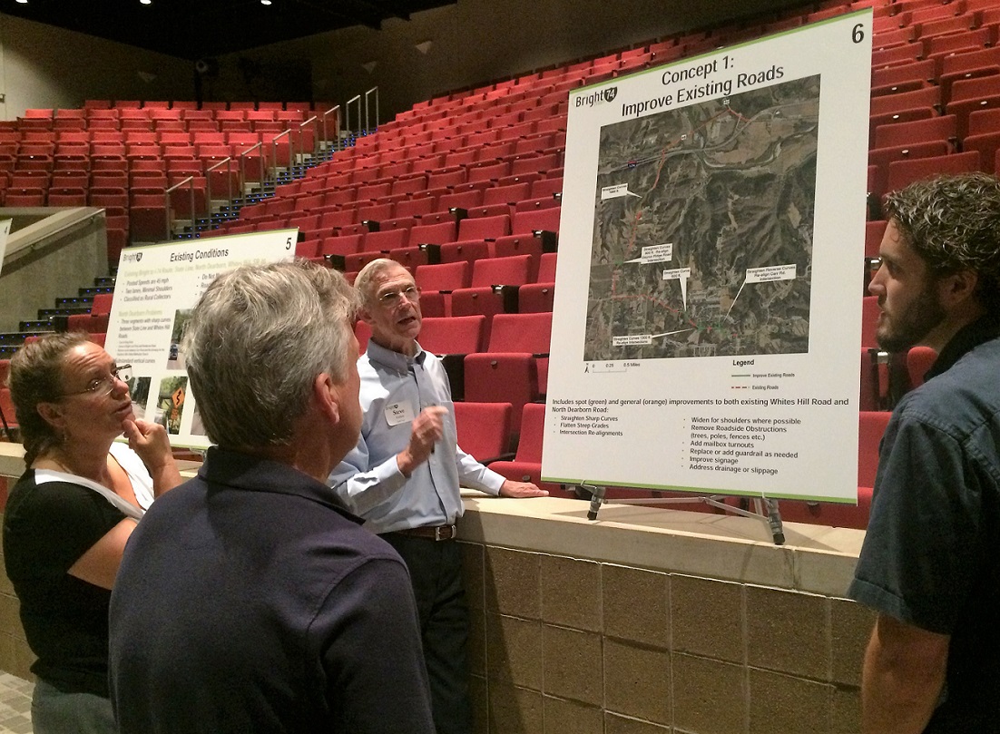
Links to the four concepts are posted below. Please click the green text to open each Concept’s exhibit. The concepts include spot improvements to existing roads and three potential new connectors between Bright and I‑74 that may also include improvements to existing roads. The concepts are not presented as engineered roadway alignments, but are shown as planning level corridor improvements. Development of the concepts was primarily based upon available GIS data sets and aerial photography.
- Concept 1 – Improve Existing Roads
- Concept 2 – Whites Hil Connector
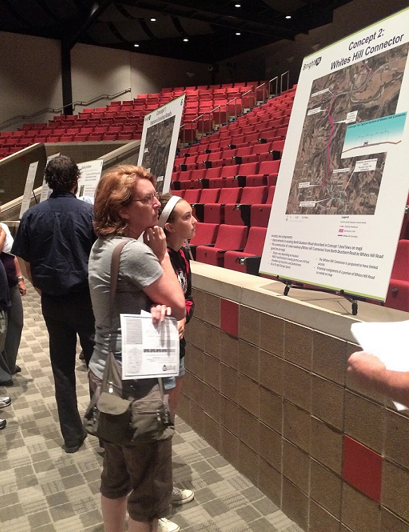
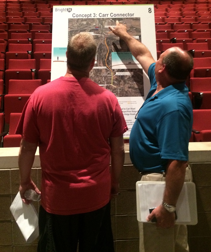
- Concept 3 – Carr Connector
- Concept 4 – State Line Connector
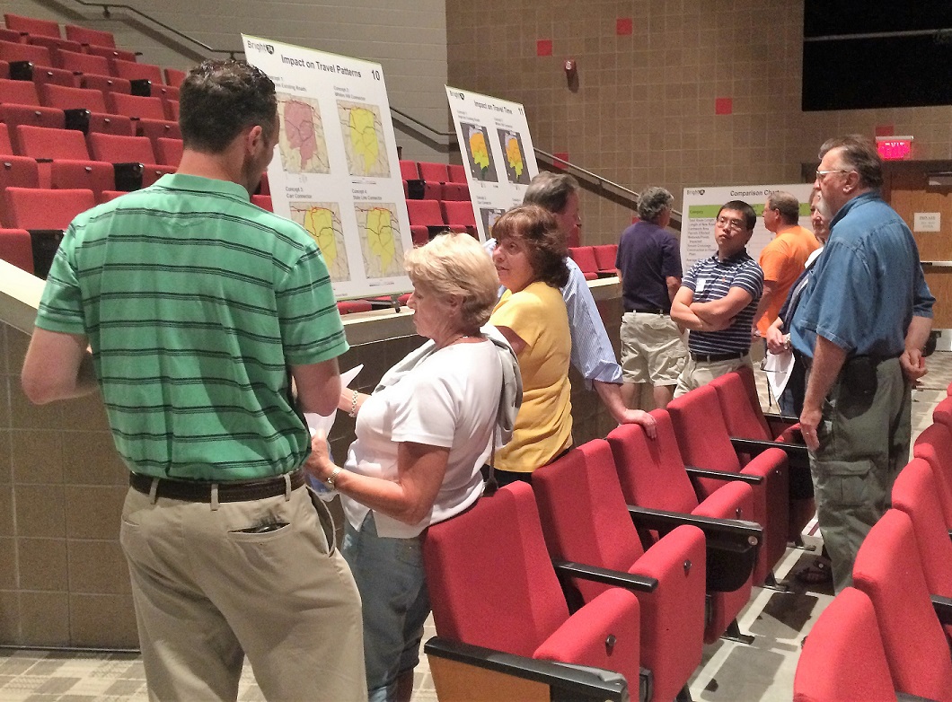
Comparison Chart
The Comparison Chart was developed so that the public could compare/contrast the different aspects of each concept. The concepts will be evaluated to determine the impacts on travel patterns, travel time, vehicle miles traveled, delay and other quantitative and qualitative measures. Right-of-way and environmental impacts, construction costs, benefits and public opinion will be considered in screening the concepts in order to make a final recommendation in Phase Three of this Study. (click on the green text in this paragraph to open each respective exhibit).
Conceptual Solutions Report
Documentation of the development, screening and evaluation of the concepts is summarized in this Conceptual Solutions Report (click the green text to open the document).
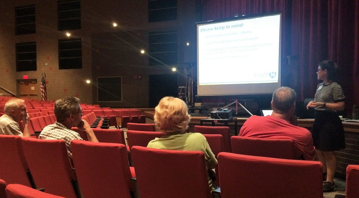
June 22, 2016 Public Open House
June 22nd Public Open House Notice
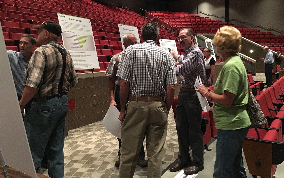
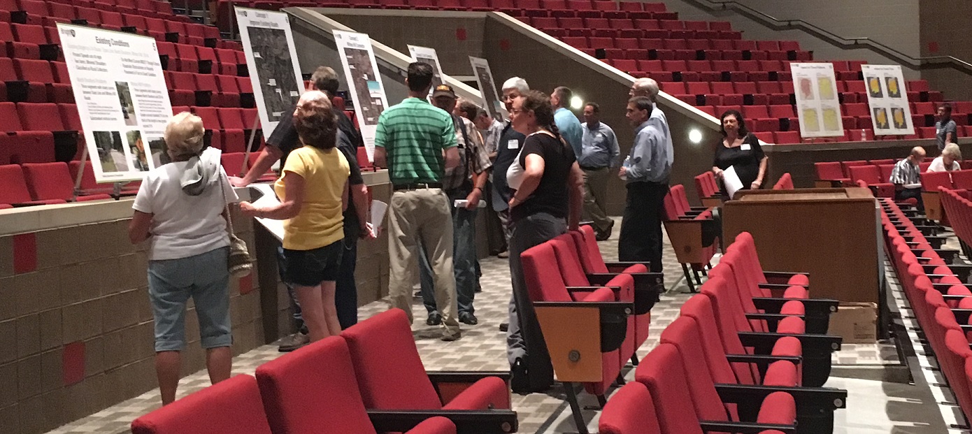
On Wednesday, June 22, 2016 from 4-7pm, a Public Open House was held at East Central High School’s Performing Arts Center. This event was the second in a series of three public involvement meetings planned for this year as part of the Bright 74 Study. The Public Open House kicked-off the start of the Study’s Phase Two 30-day public comment period. The purpose of the open house was to gather input directly from those who know the area best — residents and property owners, as well as others who frequently travel to, from or through the Bright Area. Four concepts on how travel between the Bright Area and Interstate 74 could be improved were shared. Each of the 12 Open House exhibit boards are provided below by clicking on the green text.
Public Open House Exhibits
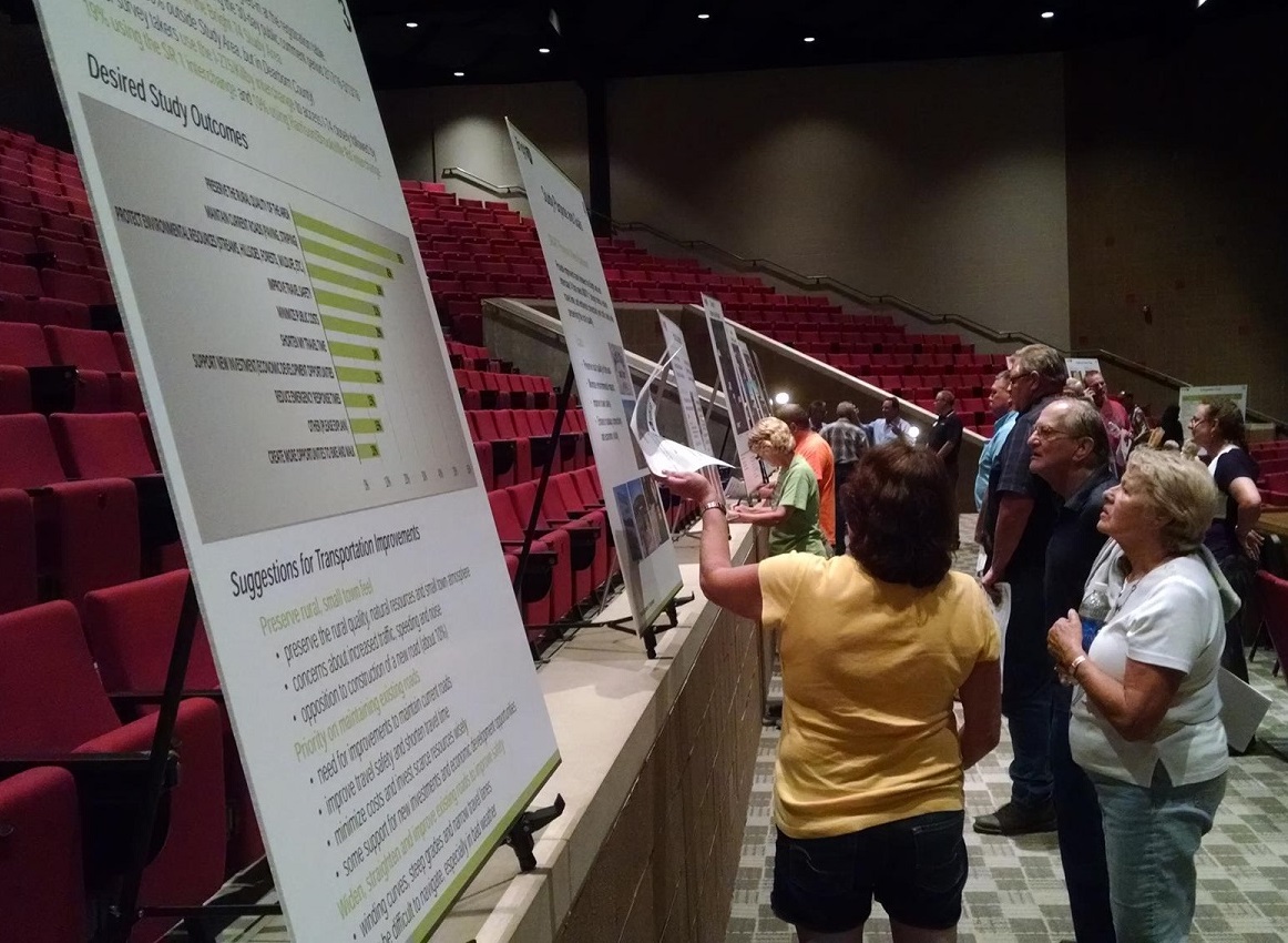
Clicking on the bulleted, green text links below will open each the exhibit boards that were presented at the June 22, 2016 Public Open House and made available on this website during Phase Two’s 30-Day Public Comment Period. The pdfs permit you to zoom in and out of the maps and information. (Note: Some of these same exhibits are also referred to above with links provided).
- Study Area
- Scope and Timeline
- Public Feedback – We have received questions on the 10% figure included on this exhibit board and wish to provide points of clarification:
- This board summarizes the 453 surveys received during Phase One of the Study.
- 42 of the 453 people who took the survey (about 10%) shared in their response to open-ended Question 10 a comment such as “no new road” or “it’s not needed.” Therefore, 10% of overall respondents specifically mentioned not wanting a new road.
- A full discussion of all survey responses is available in the Phase One Public Comment Summary Report, and all individual surveys can be viewed HERE.
- Draft Purpose and Goals
- Existing Conditions
- Concept 1 – Improve Existing Roads
- Concept 2 – Whites Hill Connector
- Concept 3 – Carr Connector
- Concept 4 – State Line Connector
- Impact on Travel Patterns
- Travel Time Changes
- Comparison Chart (numbers are general estimates)
Please note:
- The four concepts are just that – CONCEPTS. They are not engineered, ready-to-go blueprints, so please do not take lines literally. They are lines drawn to start a conversation. Please look at the general concept or route and the features of each.
- This is a planning study to determine what improvements are needed in the future — 10, 20, 30 or more years from now, so construction on any improvement will not start next year. We are planning now, so that the County can plan well in advance for any needed improvements down the road.
- No funding has been identified or secured for any of the concepts.
- Any concept chosen would very likely be constructed in phases or segments, not all at once.
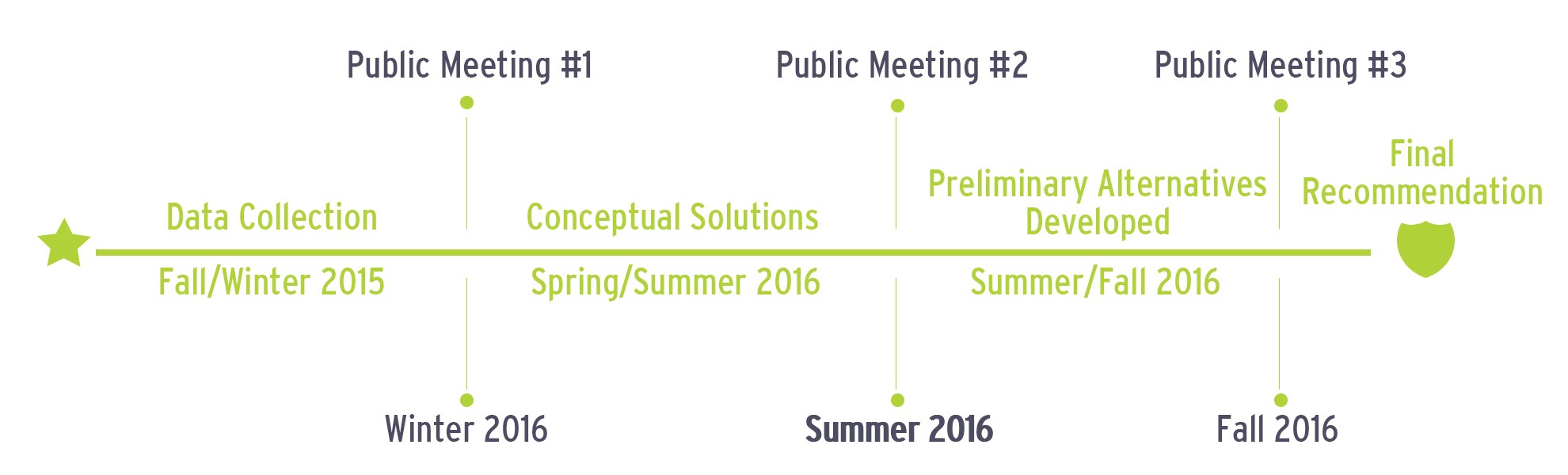
TIMELINE